Despite record U.S. heat in July, North American irradiance remains near average
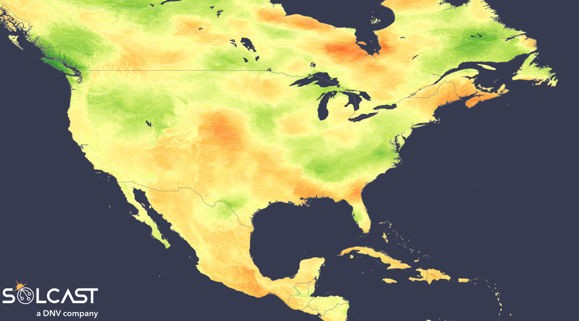
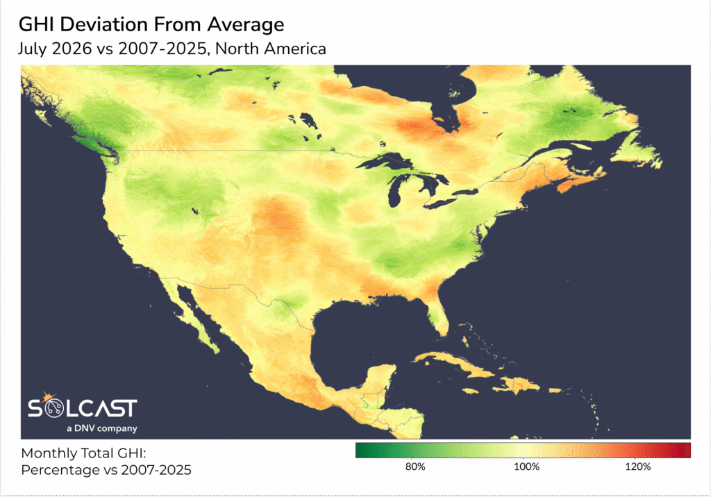
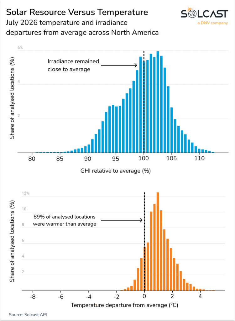
Despite the hottest July on record in the United States, net solar irradiance across North America was in line with the long-term average in July 2026. Locally, regions saw minor variations with 75% of the continent within +/- 5% of average, according to analysis using the Solcast API. Wildfire smoke in the Pacific Northwest and cloud from isolated heavy-rain events in Texas and the northeastern United States offset what would otherwise have been a stronger-than-average solar resource month.
July 2026 was the hottest month ever recorded in the United States, marking both the nation’s warmest July and warmest month of any kind in NOAA’s 132-year record. Overnight minimum temperatures were also the highest recorded for any month, according to the NCEI July 2026 National Climate Report. The exceptional heat also translated into higher electricity demand, with ERCOT reaching a record peak load of 91.1 GW on 22 July, surpassing the previous record of 85.5 GW set in August 2023, according to the U.S. Energy Information Administration.
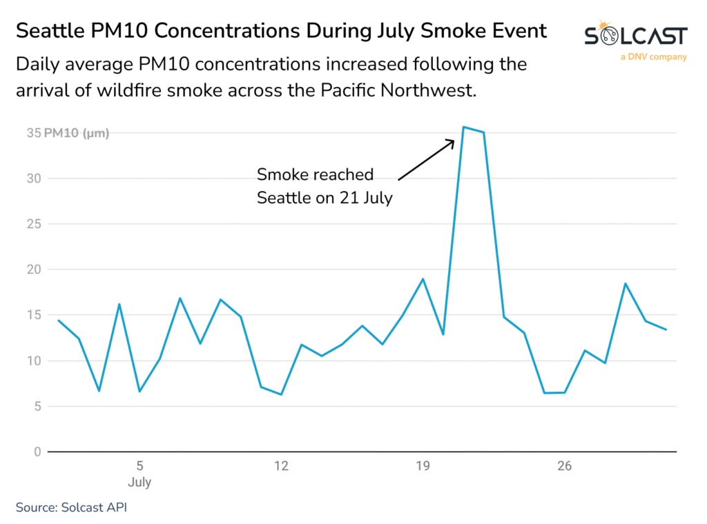
Smoke helped suppress irradiance across parts of the Pacific Northwest. Widespread fires during the second half of July produced smoke that spread across the region. Smoke impacts irradiance through particles scattering and absorbing sunlight and through increasing soiling, reducing irradiance and solar generation. These reductions offset gains elsewhere that would otherwise have made July a stronger-than-average solar resource month.
Seattle provides a local example of the broader regional event, with daily average PM10 concentrations increasing after wildfire smoke reached the Pacific Northwest on 21 July.
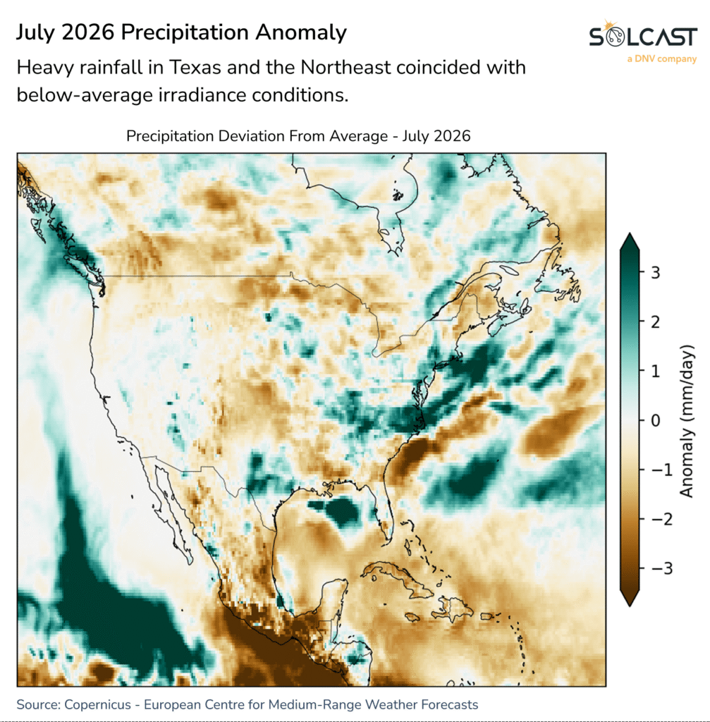
Rainfall provided another sharp contrast. Average precipitation across the United States was 64.8 mm below the long-term July average and the lowest July total since 2012.
Drought conditions expanded further, affecting nearly half of the country by early August, according to the NCEI July 2026 National Climate Report. Within that broadly dry pattern, slow-moving thunderstorms produced isolated rainfall extremes. Over 700 mm fell near Knippa, Texas, from 13 to 17 July, while parts of eastern New York received up to 300 mm across 28 and 29 July. These concentrated wet areas align with some of the lowest irradiance anomalies observed during July, highlighting the impact that persistent storm cloud can have on monthly solar resource.
Solcast produces these figures by tracking clouds and aerosols at 1-2km resolution globally, using satellite data and proprietary AI/ML algorithms. This data is used to drive irradiance models, enabling Solcast to calculate irradiance at high resolution, with typical bias of less than 2%, and also cloud-tracking forecasts. This data is used by more than 350 companies managing over 300 GW of solar assets globally.
The views and opinions expressed in this article are the author’s own, and do not necessarily reflect those held by pv magazine.
This content is protected by copyright and may not be reused. If you want to cooperate with us and would like to reuse some of our content, please contact: [email protected].
Please login to comment